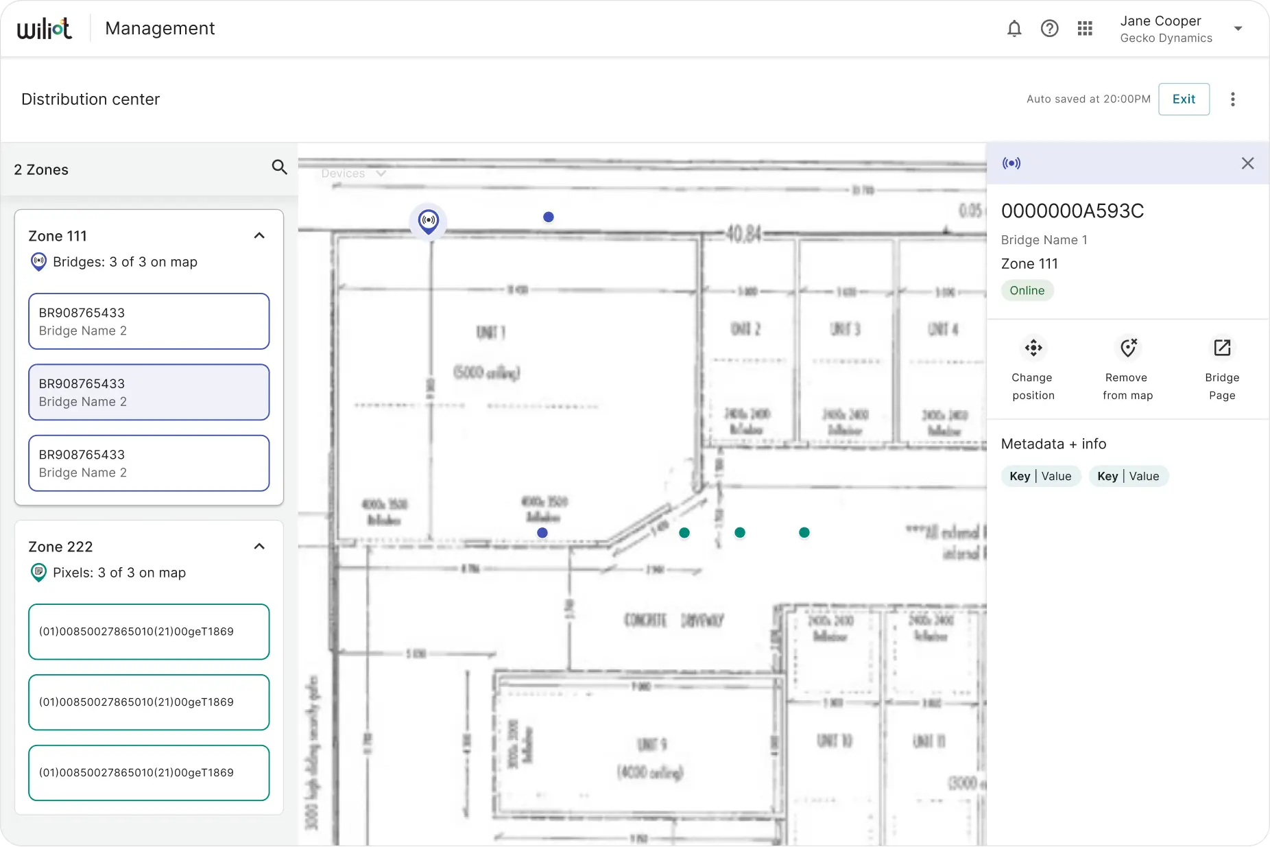
What deployers told us
Interviews with the people actually deploying Wiliot hardware in the field surfaced a set of gaps the Location module wasn't covering:
- Deployments are based on custom events, with device comments added for context
- Mobile is often the only option — facility rules restrict bringing in a laptop
- Devices get associated to a location several different ways depending on location type
- Downtime alerts already run through Opsgenie
- Deployers want map-based notifications and device status, not just a table
- Specific device locations need to be saved for API integration
- Three separate maps are used today, one each for gateways, bridges, and pixels
Where the current tools fell short
The existing Zones and Devices tabs, reviewed screen by screen, showed where deployers were losing time.
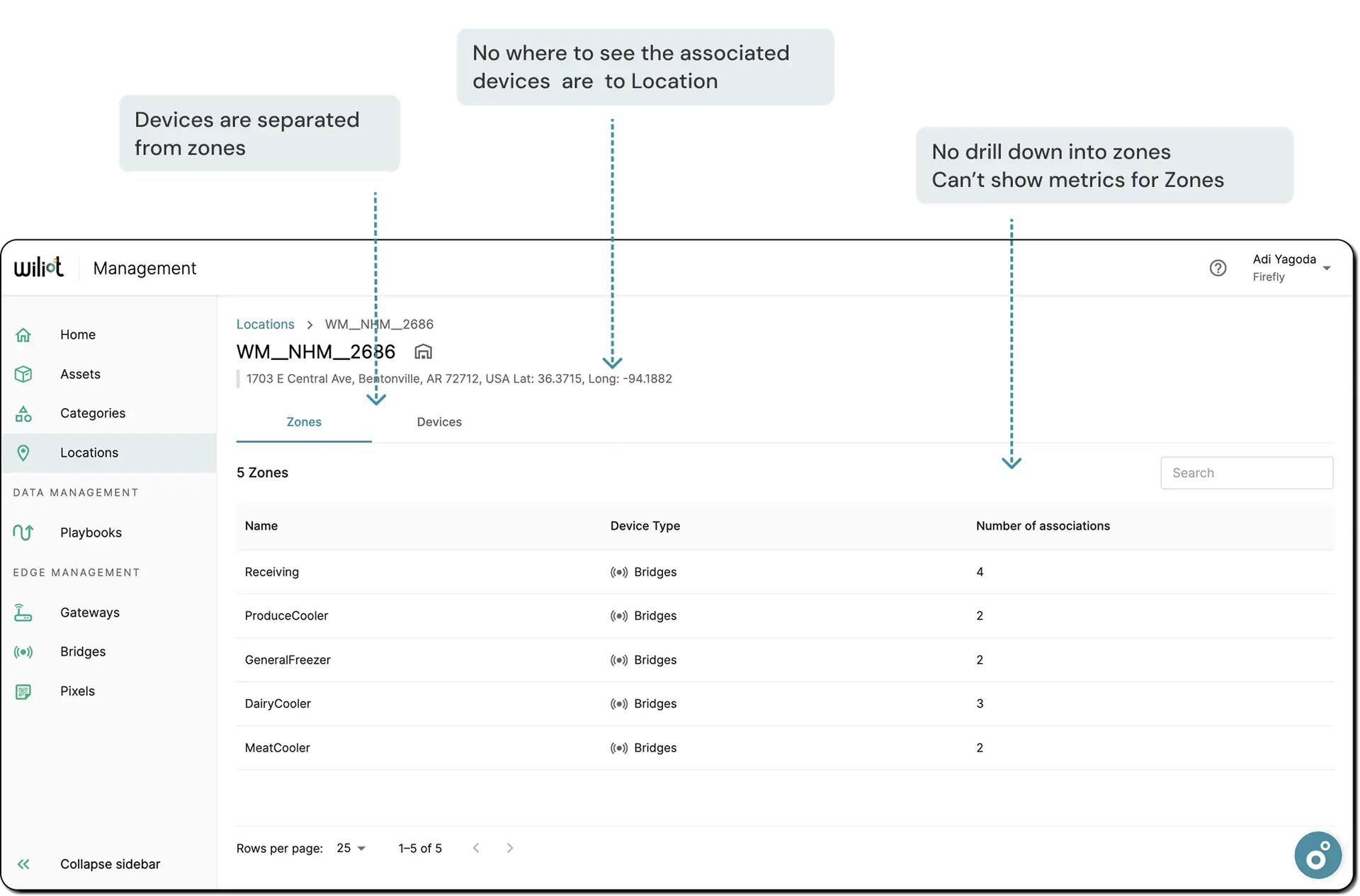
The old Zones tab — devices were separated from zones, there was no way to see which devices belonged to a location, and no drill-down into a zone's own metrics.
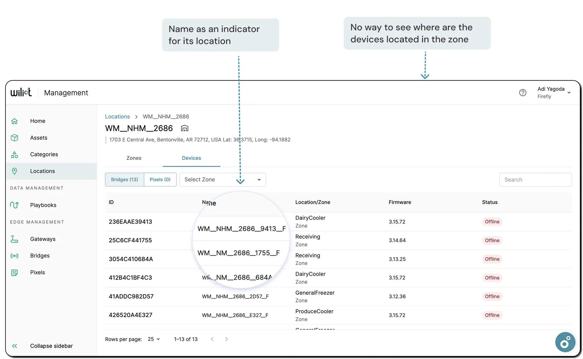
The old Devices tab — a device's zone was only visible through its name, and there was no way to see where devices actually sat within a zone.
What we decided to prioritize
Position devices on a real map
Bring device placement onto an actual facility map, with metadata attached to each pin, instead of three separate maps split by device type.
Default zone creation
Generate a sensible starting set of zones automatically, rather than asking a deployer to define every zone from scratch.
Roles and permissions for map actions
Define who is allowed to place, move, or remove a device on the map, instead of leaving it open to anyone with access.
Drill into a zone
Let a deployer open a zone and see the full list of devices inside it.
Where this landed
This stayed at the wireframe stage rather than shipping in full. The plan was a phased MVP, proving out default zones and device-to-location association before taking on full map integration.
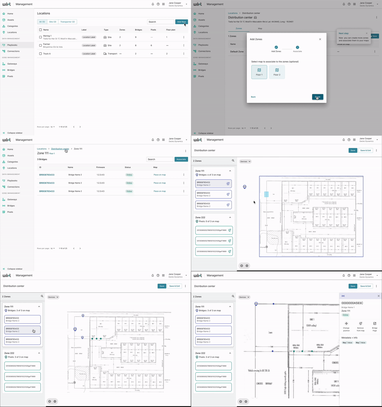
Wireframe walkthrough — early click-through of positioning a device on a zone map, recorded during testing.
Where we're headed
Want to go deeper on any of this?
Happy to walk through the field interviews, the zone/device association options we considered, or why this stayed at wireframe stage.